Channel Islands National Marine Sanctuary National Park
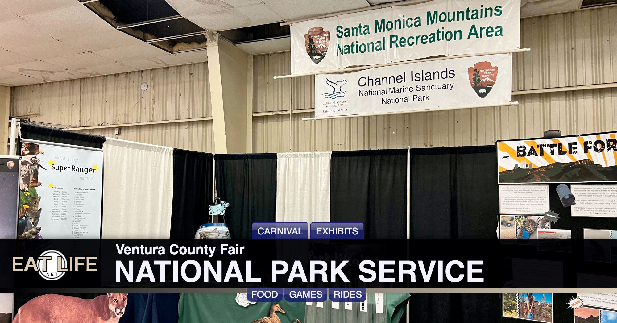
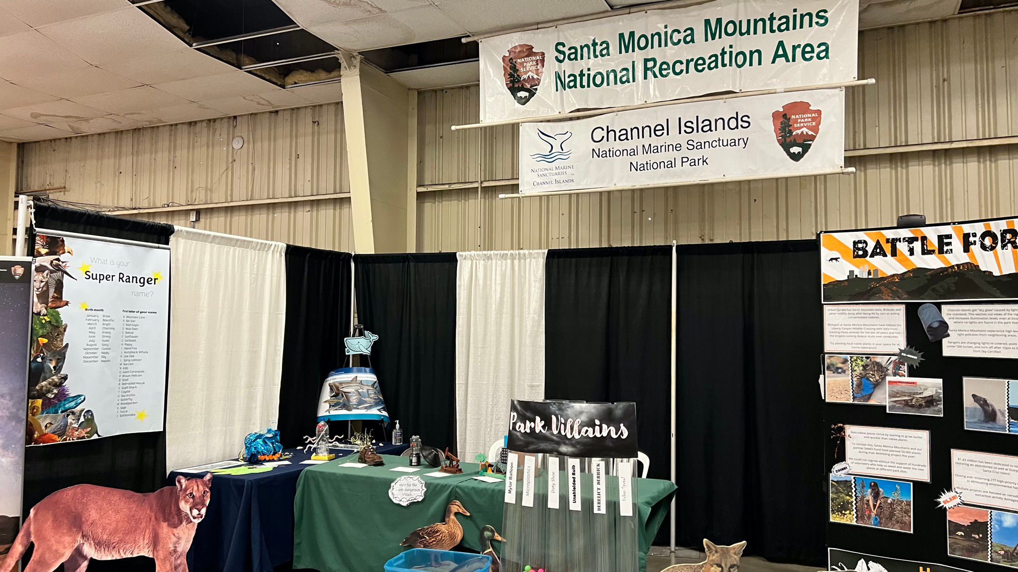
Park Villains
- Mylar Ballon
- Microplastics
- Dirty Shoe
- Unshielded Bulb
- Derelict Derrick
- Urban Sprawl
Santa Monica Mountains National Recreation Area:
Hidden in plain sight from Los AngelesThe Santa Monica Mountains offer easy access to surprisingly wild places. Experience the famous beaches of Malibu or explore more than 500 miles of trails. The park abounds with historical and cultural sites, from old movie ranches to Native American centers.
History
The landscape of the Santa Monica Mountains was not just created by geological forces, altered by weather, or covered by vegetation, but shaped by the people who lived and worked here.People came to this area for many reasons. Initially, the Chumash and Tongva called the Santa Monica Mountains home. Then Spanish Explorers passed through these lands, followed by Rancheros and Homesteaders who worked the land they lived on. Still today, people work, travel, and recreate in the Santa Monica Mountains and call this place their home.
There are places that still remain from our past. Places we can touch and feel. Paramount Ranch, Solstice Canyon, and Rancho Sierra Vista / Satwiwa. All places that you can visit. Places that most importantly, create an emotional and intellectual connection to our past.
As a park, we look deep into the past through archeology and historical research. Investigating what people left behind. Into their past and the collections that tell the day to day story of their lives. From photographs to letters to even the things they threw away; everything tells a part of the story we share.
NPSSanta Monica Mountains National Recreation Area strives to ensure the preservation of these collections, places, and stories of the people who impacted the landscape foreverNature
Located adjacent to the city of Los Angeles, the second largest urban area in the United States, Santa Monica Mountains National Recreation Area protects one of the largest and most significant examples of Mediterranean-type ecosystems in the world. The climate of the Mediterranean ecosystem, characterized by wet winters and warm, dry summers, along with the diverse topography in the Santa Monica Mountains has created a landscape filled with unique natural resources.The Santa Monica Mountains are part of the east-west trending Transverse Ranges of Southern California. The range is geologically complex and characterized by steep, rugged mountain slopes and canyons. Elevations range from sea level to more than 3,000 feet. The Santa Monica Mountains are adjacent to 46 miles of scenic California coastline with sandy beaches and rocky tide pools and lagoons.
There is tremendous ecological diversity within the Santa Monica Mountains. The mountains are home to over 1,000 plant species making up 26 distinct natural communities, from freshwater aquatic habitats and two of the last salt marshes on the Pacific Coast, to oak woodlands, valley oak savannas, coastal sage, and chaparral. Numerous mammals are found in the Santa Monica Mountains, including bobcats, coyotes, and mountain lions. Nearly 400 species of birds have been observed and another 35 species of reptiles and amphibians can also be found in the mountains. The Santa Monica Mountains are home to more than 50 threatened or endangered plants and animals - among the highest concentrations of such rare species in the United States.
Places to Go
- Arroyo Sequit
- Cheeseboro and Palo Camado Canyons
- Circle X Ranch
- Franklin Canyon Park
- King Gillette Ranch
- Paramount Ranch
- Peter Strauss Ranch
- Rancho Sierra Vista / Satwiwa
- Rocky Oaks
- Solstice Canyon
- Visitor Center (Interagency)
- Zuma and Trancas Canyons
State Parks
- Malibu Creek State Park
- Leo Carrillo State Park
- Point Dume State Reserve
- Point Mugu State Park
- R. H. Meyer Memorial State Beaches
- Baldwin Hills Scenic Overlook
- Malibu Lagoon State Beach
- Topanga State Park
- Will Rogers State Historic Park
Mountains Recreation and Conservation Authority
- Corral Canyon Park
- Franklin Canyon Park
- LA River Center & Gardens
- Malibu Bluffs Open Space
- Marvin Braude Mulholland Gateway Park
- San Vicente Mountain Park
- Temescal Gateway Park
- Upper Las Virgenes Canyon Open Space Preserve
City of Los Angeles
- Griffith Park
- Runyon Canyon Park
- Zuma Beach County Park
NPS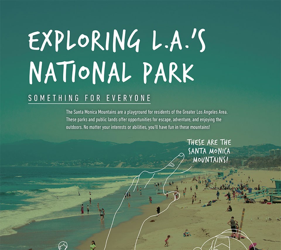 Exploring LA's National Park
Something for Everyone. The Santa Monica Mountains are a playground for residents of the Great Los Angeles Area. These parks and public lands offer opportunities for escape, adventure, and enjoying the outdoors. No matter your interest or abilities, you'll have fun in these mountains!
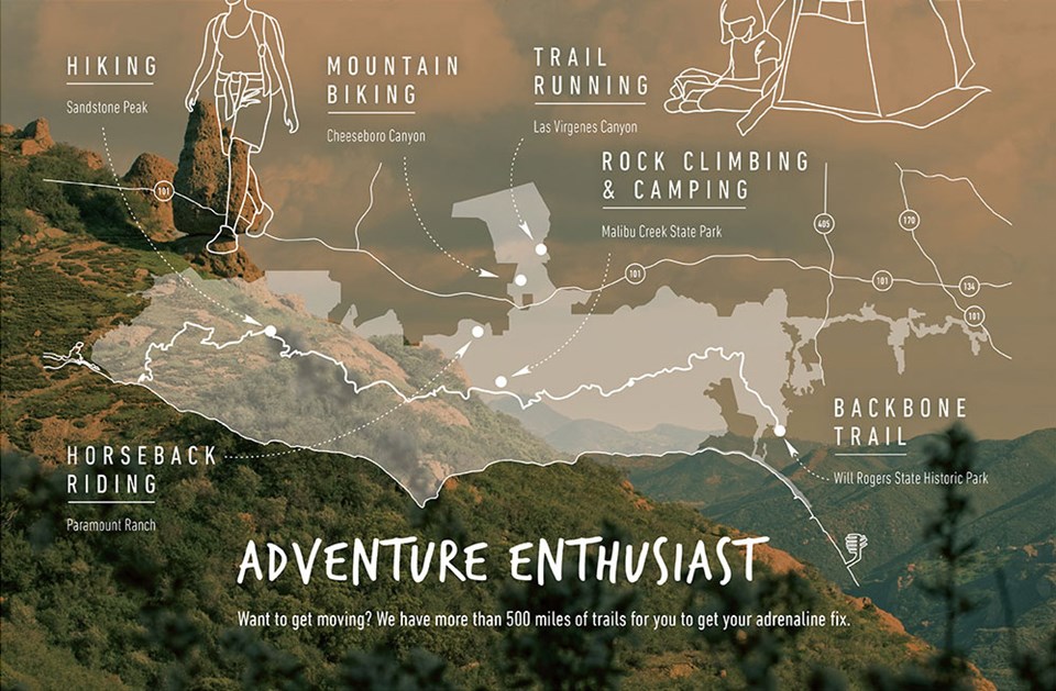 Adventure Enthusiast
Want to get moving? We have more than 500 miles of trails for you to get your adrenaline fix. Hiking at Sandstone Peak, mountain biking at Cheeseboro Canyon, trail running at Las Virgenes Canyon, rock climbing and camping at Malibu Creek State park, horseback riding at Paramount Ranch, and the Backbone Trail at Will Rogers State Historic Park.
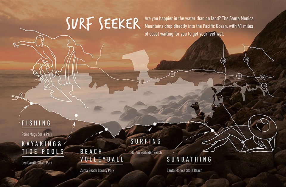 Surf Seeker
Are you happier in the water than on land? The Santa Monica Mountains drop directly into the Pacific Ocean, with 41 miles of coast waiting for you to get your feet wet. There's fishing at Point Mugu State Park, kayaking and tide pools at Leo Carrillo State Park, beach volleyball at Zuma Beach County Park, surfing at Malibu Surfrider Beach, and subathing at Santa Monica State Beach.
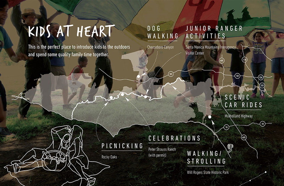 Kids at Heart
This is the perfect place to introduce kids to the outdoors and spend some quality family time together. Picnicking at Rocky Oaks, celebrations at Peter Strauss Ranch (with permit), dog walking at Cheeseboro Canyon, Junior Ranger activities at Santa Monica Mountains Interagency Visitor Center, walking/strolling at Will Rogers State Historic Park, and scenic car rides on Mulholland Highway.
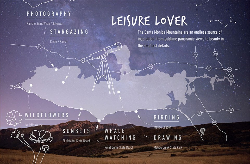 Leisure Lover
The Santa Monica Mountains are an endless source of inspiration, from sublime panoramic views to beauty in the smallest details. Enjoy photography at Rancho Sierra Vista/Satwiwa, stargazing at Circle X Ranch, wildflowers at La Jolla Valley, sunsets at El Matador State Beach, whale watching at Point Dume State Beach, birding at Malibu Lagoon, and drawing at Malibu Creek State Park.
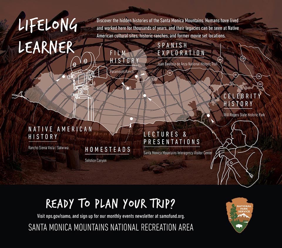 Life Long Learner
Discover the hidden histories of the Santa Monica Mountains. Humans have lived and worked here for thousands of years, and their legacies can be seen at Native American cultural sites, historic ranches, and former movie set locations. Learn about Native American history at Rancho Sierra Vista/Satwiwa, homesteads at Solstice Canyon, film history at Paramount Ranch, Spanish exploration at Juan Bautista de Anza National Historic Trail, lectures and presentations at Santa Monica Mountains Interagency Visitor Center, and celebrity history at Will Rogers State Historic Park.
Channel Islands National Marine Sanctuary:
Channel Islands National Marine Sanctuary was designated in 1980 by the National Oceanic and Atmospheric Administration. Located off the coast of Santa Barbara and Ventura counties in Southern California, 350 miles south of San Francisco and 95 miles north of Los Angeles, the sanctuary encompasses approximately 1,470 square miles of ocean waters around Anacapa, Santa Cruz, Santa Rosa, San Miguel, and Santa Barbara islands, extending from the mean high tide of these islands to six nautical miles offshore, and surrounding Channel Islands National Park.The sanctuary's remote, isolated position at the confluence of two major ocean currents supports remarkable biodiversity and productivity. It's a special place for endangered species, sensitive habitats, historic shipwrecks, other maritime heritage artifacts, and living Chumash culture. Many valuable commercial and recreational activities thrive in the sanctuary, such as fishing, shipping, and tourism.
The sanctuary was federally designated because of its national significance as an area of exceptional natural beauty and resources, and due to heightened concerns following the 1969 oil spill in the Santa Barbara Channel. Protection of sanctuary resources is supported through research, education, conservation, and stewardship programs. The primary goal of the sanctuary is the protection of natural and cultural resources contained within its boundaries. The sanctuary is managed to promote ecosystem conservation, protect cultural resources, and support compatible human uses.
CINMSChannel Islands National Marine Sanctuary is recognized as an ecologically significant marine ecosystem, supporting tremendous biodiversity in close proximity to highly populated Southern California. A wide range of sanctuary research and monitoring projects reflects this confluence of people and nature, as well as the diversity of science partners involved.Visiting
Visiting the Channel Islands is like traveling back into the past. Here you can discover a world protected for current and future generations to explore, learn from, and enjoy. The Channel Islands are accessible year round. Variations in weather, underwater visibility, wildlife migration and spawning cycles, as well as seasonal changes in plant life, present a variety of experiences that change constantly.Close to the California mainland, yet worlds apart, Channel Islands National Marine Sanctuary and National Park encompass the ocean environment and five of the eight California Channel Islands (Anacapa, Santa Cruz, Santa Rosa, San Miguel, and Santa Barbara). The islands' remote, isolated position at the confluence of two major ocean currents creates remarkable biodiversity. The Channel Islands offer adventure and breathtaking scenery just 100 miles from Los Angeles.
Heritage
The abundant natural resources of the sanctuary have attracted and supported seafaring people for thousands of years. Channel Islands National Marine Sanctuary is rich in maritime heritage, from living Chumash culture to historic shipwreck resources. Sanctuary waters are a significant maritime trade route connecting people and communities with one another and other parts of the world.
- Shipwrecks
Over the last two centuries, some 300 ships have met their fate among the rocks and reefs of the Santa Barbara Channel Islands
A Sunken Legacy Europeans sailing along the West Coast of North America began to explore the region in the 16th century. The abundant resources of both the islands and the surrounding sea attracted large-scale fishing and farming industries, while their strategic location brought a military presence that continues to this day.Dynamic weather, strong prevailing winds, and other natural hazards made navigating the waters around the Channel Islands challenging. Between 1853 and 1980, more than 150 historic ships and aircraft are known to have wrecked within the boundaries of Channel Islands National Marine Sanctuary and National Park.
Historic wrecks tell us a great deal about the development of maritime trade in the region. From passenger ships carrying 49ers hoping to get rich in the California Gold Rush, to local steamers and international cargo vessels, each wreck tells another chapter in a story that continues to this day.
- Chumash
The island and marine ecosystems co-evolved with the Chumash and their culture. Chumash maritime culture has been and continues to be intimately shaped by that connection.
Chumash History The northern Channel Islands and the surrounding waters have a rich human history dating back more than 13,000 years. For the Chumash, or island people, who are indigenous to the region surrounding the Santa Barbara Channel, the northern Channel Islands and adjacent waters hold a value that is beyond measure. The island and marine ecosystems co-evolved with the Chumash and their culture. Chumash maritime culture has been, and continues to be, intimately shaped by that connection.https://sanctuaries.noaa.gov//media/docs/2016-condition-report-channel-islands-nms.pdf#page=187
CINMSChannel Islands National Marine Sanctuary protects one of our nation's most treasured marine environments so that current and future generations can use and enjoy it. The sanctuaries work with partners and the Sanctuary Advisory Council to promote long-term conservation of sanctuary waters, wildlife, habitats, ecosystems, and maritime archaeological resources, while allowing compatible human uses.
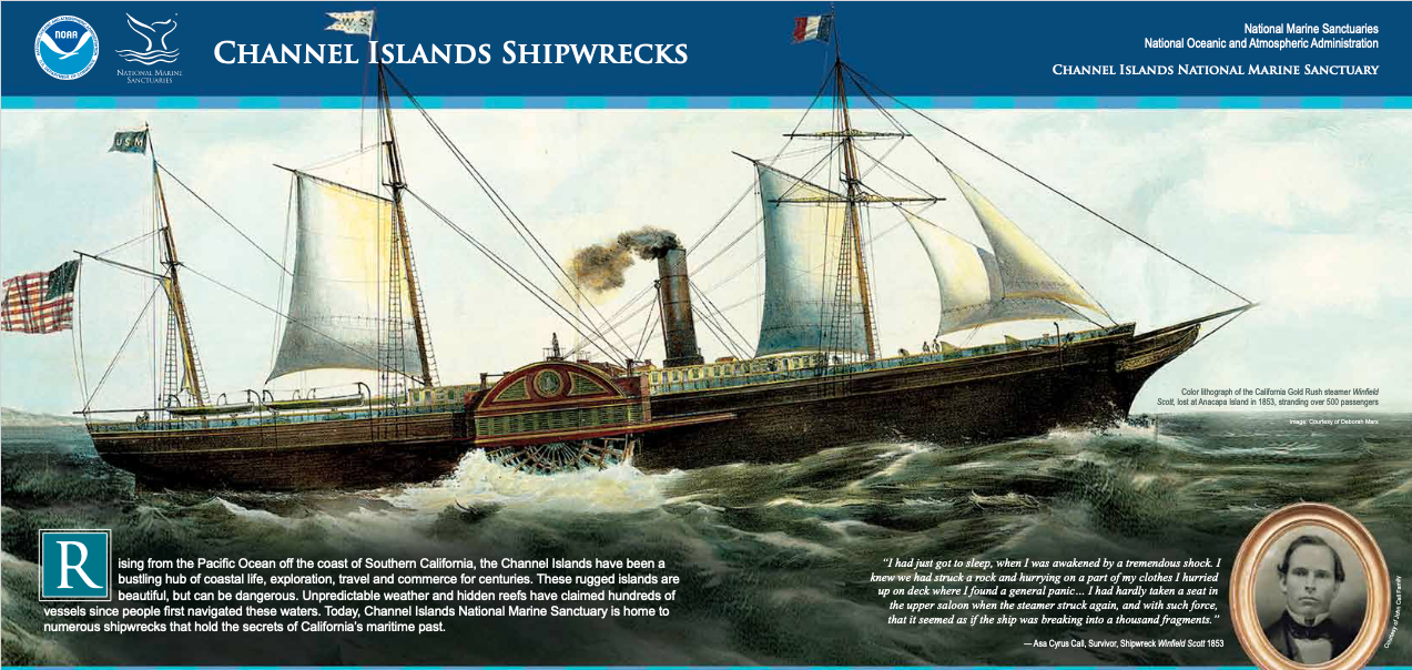 Channel Island Shipwrecks
Rising from the Pacific Ocean off the coast of Southern California, the Channel Islands have been a bustling hub of coastal life, exploration, travel and commerce for centuries. These rugged islands are beautiful, but can be dangerous. Unpredictable weather and hidden reefs have claimed hundreds of vessels since people first navigated these waters. Today, Channel Islands National Marine Sanctuary is home to numerous shipwrecks that hold the secrets of California’s maritime past.I had just got to sleep, when I was awakened by a tremendous shock. I knew we had struck a rock and hurrying on a part of my clothes I hurried up on deck where I found a general panic... I had hardly taken a seat in the upper saloon when the steamer struck again, and with such force, that it seemed as if the ship was breaking into a thousand fragments."
- Asa Cyrus Call, Survivor, Shipwreck Winfield Scott 1853
 A Rich Maritime Heritage
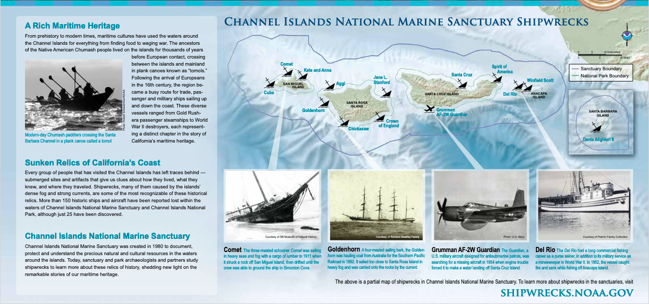
From prehistory to modern times, maritime cultures have used the waters around the Channel Islands for everything from finding food to waging war. The ancestors of the Native American Chumash people lived on the islands for thousands of years before European contact, crossing between the islands and mainland in plank canoes known as “tomols." Following the arrival of Europeans in the 16th century, the region became a busy route for trade, passenger and military ships sailing up and down the coast. These diverse vessels ranged from Gold Rush era passenger steamships to World War II destroyers, each representing a distinct chapter in the story of California’s maritime heritage.Sunken Relics of California’s Coast
Every group of people that has visited the Channel Islands has left traces behind - submerged sites and artifacts that give us clues about how they lived, what they knew, and where they traveled. Shipwrecks, many of them caused by the islands’ dense fog and strong currents, are some of the most recognizable of these historical relics. More than 150 historic ships and aircraft have been reported lost within the waters of Channel Islands National Marine Sanctuary and Channel Islands National Park, although just 25 have been discovered.Channel Islands National Marine Sanctuary Shipwrecks
Channel Islands National Marine Sanctuary was created in 1980 to document, protect and understand the precious natural and cultural resources in the waters around the islands. Today, sanctuary and park archaeologists and partners study shipwrecks to learn more about these relics of history, shedding new light on the remarkable stories of our maritime heritage.
- Comet The three-masted schooner Comet was sailing in heavy seas and fog with a cargo of lumber in 1911 when it struck a rock off San Miguel Island, then drifted until the crew was able to ground the ship in Simonton Cove.
- Goldenhorn A four-masted sailing bark, the Golden horn was hauling coal from Australia for the Southern Pacific Railroad in 1892. It sailed too close to Santa Rosa Island in heavy fog and was carried onto the rocks by the current.
- Grumman AF-2W Guardian The Guardian, a U.S. military aircraft designed for antisubmarine patrols, was searching for a missing aircraft in 1954 when engine trouble forced it to make a water landing off Santa Cruz Island.
- Del Rio The Del Rio had a long commercial fishing career as a purse seiner, in addition to its military service as a minesweeper in World War II. In 1952, the vessel caught fire and sank while fishing off Anacapa Island.
The above is a partial map of shipwrecks in Channel Islands National Marine Sanctuary. To learn more about shipwrecks in the sanctuaries, visit [ https://channelislands.noaa.gov/maritime/shipwrecks.html ]
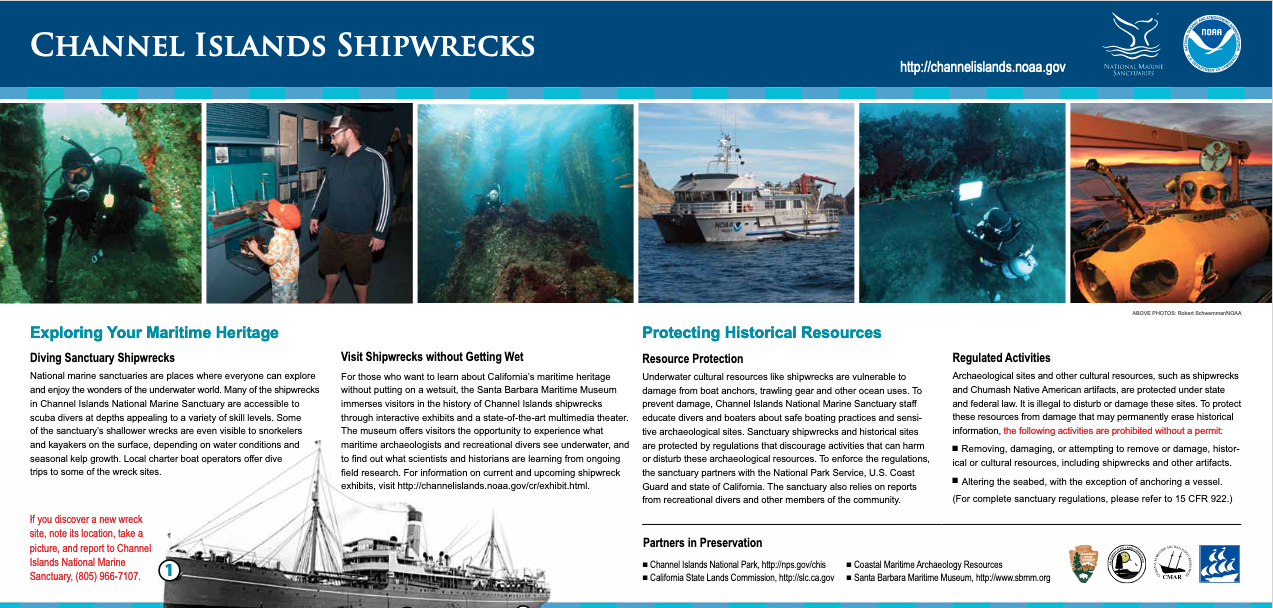 Exploring Your Maritime Heritage
Diving Sanctuary Shipwrecks
National marine sanctuaries are places where everyone can explore and enjoy the wonders of the underwater world. Many of the shipwrecks in Channel Islands National Marine Sanctuary are accessible to scuba divers at depths appealing to a variety of skill levels. Some of the sanctuary’s shallower wrecks are even visible to snorkelers and kayakers on the surface, depending on water conditions and seasonal kelp growth. Local charter boat operators offer dive trips to some of the wreck sites.Visit Shipwrecks without Getting Wet
For those who want to learn about California’s maritime heritage without putting on a wetsuit, the Santa Barbara Maritime Museum immerses visitors in the history of Channel Islands shipwrecks through interactive exhibits and a state-of-the-art multimedia theater. The museum offers visitors the opportunity to experience what maritime archaeologists and recreational divers see underwater, and to find out what scientists and historians are learning from ongoing field research.Protecting Historical Resources
Underwater cultural resources like shipwrecks are vulnerable to damage from boat anchors, trawling gear and other ocean uses. To prevent damage, Channel Islands National Marine Sanctuary staff educate divers and boaters about safe boating practices and sensitive archaeological sites. Sanctuary shipwrecks and historical sites are protected by regulations that discourage activities that can harm or disturb these archaeological resources. To enforce the regulations, the sanctuary partners with the National Park Service, U.S. Coast Guard and state of California. The sanctuary also relies on reports from recreational divers and other members of the community.Regulated Activities
Archaeological sites and other cultural resources, such as shipwrecks and Chumash Native American artifacts, are protected under state and federal law. It is illegal to disturb or damage these sites. To protect these resources from damage that may permanently erase historical information, the following activities are prohibited without a permit:
- Removing, damaging, or attempting to remove or damage, historical or cultural resources, including shipwrecks and other artifacts
- Altering the seabed, with the exception of anchoring a vessel
Partners in Preservation
- Channel Islands National Park, [ http://nps.gov/chis ]
- California State Lands Commission, [ http://slc.ca.gov ]
- Coastal Maritime Archaeology Resources
- Santa Barbara Maritime Museum, [ http://www.sbmm.org ]
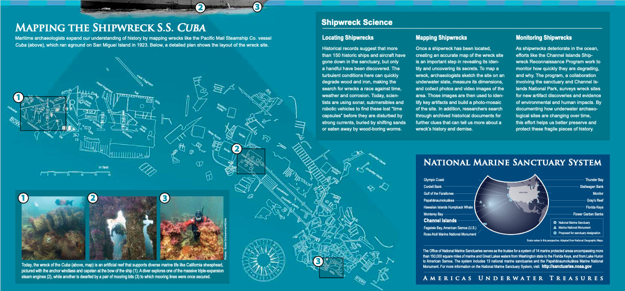 Mapping the Shipwreck S.S. Cuba
Today, the wreck of the Cuba (above, map) is an artificial reef that supports diverse marine life like California sheephead, pictured with the anchor windlass and capstan at the bow of the ship
- A diver explores one of the massive triple-expansion steam engines
- while another is dwarfed by a pair of mooring bits
- to which mooring lines were once secured
Shipwreck ScienceLocating Shipwrecks
Historical records suggest that more than 150 historic ships and aircraft have gone down in the sanctuary, but only a handful have been discovered. The turbulent conditions here can quickly degrade wood and iron, making the search for wrecks a race against time, weather and corrosion. Today, scientists are using sonar, submersibles and robotic vehicles to find these lost “time capsules" before they are disturbed by strong currents, buried by shifting sands or eaten away by wood-boring worms.Mapping Shipwrecks
Once a shipwreck has been located, creating an accurate map of the wreck site is an important step in revealing its identity and uncovering its secrets. To map a wreck, archaeologists sketch the site on an underwater slate, measure its dimensions, and collect photos and video images of the area. Those images are then used to identify key artifacts and build a photo-mosaic of the site. In addition, researchers search through archived historical documents for further clues that can tell us more about a wreck’s history and demise.Monitoring Shipwrecks
As shipwrecks deteriorate in the ocean, efforts like the Channel Islands Ship wreck Reconnaissance Program work to monitor how quickly they are degrading, and why. The program, a collaboration involving the sanctuary and Channel Islands National Park, surveys wreck sites for new artifact discoveries and evidence of environmental and human impacts. By documenting how underwater archaeological sites are changing over time, this effort helps us better preserve and protect these fragile pieces of historyThe Office of National Marine Sanctuaries serves as the trustee for a system of 14 marine protected areas encompassing more than 150,000 square miles of marine and Great Lakes waters from Washington state to the Florida Keys, and from Lake Huron to American Samoa. The system includes 13 national marine sanctuaries and the Papahanaumokuakea Marine National Monument. For more information on the National Marine Sanctuary System, visit: [ http://sanctuaries.noaa.gov ]


